Millions of Americans in the South and Northeast are in for a soggy, stormy week as an unusual weather pattern takes hold.
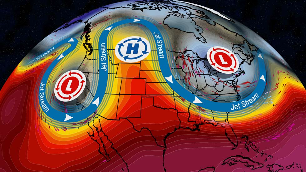
Meteorologists say an “omega block” — a rare atmospheric setup — is behind the lingering storms and potential for severe weather and flooding.
This omega block, named for the Greek letter Ω, is causing the jet stream to stall over the U.S. Instead of flowing smoothly west to east, it’s getting “stuck,” trapping storms in place. Think of it like a giant boulder in a stream, forcing water — or in this case, storms — to pile up.
The result? Several days of unsettled, sometimes dangerous, weather.
In Texas, especially cities like Fort Worth, Austin, and San Antonio, strong storms could bring damaging winds, large hail, and flash flooding, particularly in West Texas where rain has already saturated the ground.

READ ALSO: Florida man threatened to kill Trump and investigating Secret Service agent
On the East Coast, from the mid-Atlantic up through the Northeast, including the New York tri-state area, repeated rounds of showers and storms are expected to raise the risk of flash flooding.
As the week continues, the storm threat will stretch into Louisiana, Arkansas, Oklahoma, and Mississippi, with Tuesday expected to be particularly active. Forecasters warn that, in addition to flooding, an isolated tornado can’t be ruled out.
By Wednesday, the severe weather threat will start to ease slightly, but localized heavy rain could still trigger more flash floods, especially near the Gulf Coast.
The good news? The blocking pattern is expected to slowly weaken later in the week, allowing the storms to finally move out.
Until then, residents in the affected areas are urged to stay alert, watch local forecasts, and prepare for possible flooding or power outages.


